
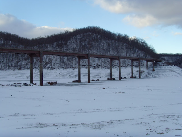
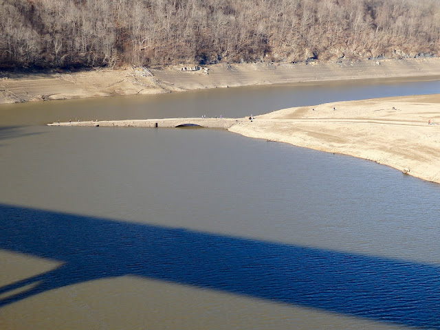
As you drive down Rt 40, across the Youghiogheny reservoir heading towards Maryland, you might not notice what lies underneath you. Somerfield became a town in 1818. It existed for over 100 years until the 1940's. In 1942 the Yough was dammed and the town of Somerfield was abandoned to make room for the newly forming lake. Every so often, the water levels recede and the old stone bridge that was the original Rt. 40 and derelict sidewalks of the town will show themselves. The first image courtesy of gribblenation.com, and the two non snowy pictures courtesy Vince Ferrari. The remainder are from a recent trip through the area.





A nice article about Somerfield is here.
The following pictures were sent to our FaceBook page by Jack Gates.......We thank him!


Some new shots from fall 2024 below:


I'm an interactive map! Play w/ me!
View Larger Map
A nice interactive map of the area now. Somerfield was located about 5 mm above the 40 sign on the map above. If you were to click on the "View Larger Map" link, a little orange/yellow guy should appear above the zoom controls and you can drag him to the above location for a 360 degree view of the non flooded area.
 |
| View from the middle of the current bridge, albeit 80 years ago. |


 |
| And todays view. (photo courtesy Vince Ferrari) |
 |
| The new Rt. 40 bridge crossing the Yough |


The old Rt. 40 approaching the bridge
 |
| Somerfield Bridge |


The new and the old. The stone bridge was once the longest bridge constructed on the original Rt. 40

 |
| Somerfield PA sidewalk |
Snow covered sidewalks of the old town, whose blocks of old sidewalk can easily be seen under the right conditions.

A wide shot
 |
| November 19, 2015 |
 |
| November 19, 2015 |
 |
| November 19, 2015 |


A nice article about Somerfield is here.
 |
| Courtesy V. Ferrari. |
 |
| The bridge after towns demolition |
 |
| 1979 |


View Larger Map
A nice interactive map of the area now. Somerfield was located about 5 mm above the 40 sign on the map above. If you were to click on the "View Larger Map" link, a little orange/yellow guy should appear above the zoom controls and you can drag him to the above location for a 360 degree view of the non flooded area.

