Exploring and photographing southwestern PA's abandoned mines, industry, homes...and whatever else we may find. A little history, a little legend...from the most massive structures to the minute details we walk past every day.
Today, on September 12, 2011, the Millsboro bridge, located at the bottom of Greene County hill on PA-88 was demolished by implosion at 5:07 pm. The bridge, built in 1932, was one of the last remaining bridges left in Pennsylvania with a double X heavy lattice style of portal bracing.
The 313'-long, skewed, 2 simple span, riveted Pratt thru truss bridge is supported on reinforced concrete abutments with flared wingwalls and a concrete pier. The upper chords are built-up members. The bottom chords, vertical members, stringers, and floorbeams are rolled section. A lattice railing is inside the downstream truss, and the sidewalk cantilevered off the upstream truss also has a lattice railing. The bridge has no innovative or distinctive details, including the use of rolled sections for most truss members which was introduced in the mid 1920s, and it is an example of common period technology. Neither the bridge nor its setting are historically or technologically significant.
On the morning of September 12, I headed out with my dad to watch the bridge implosion, only to arrive and find out after an hour and a half that the demolition time had been moved from 10 am, to 4pm, so home we went. We arrived back at the site at 3pm to make sure that we didn't miss anything important.
The first set of pictures is from our great hilltop view (from the ridge alongside Greene County hill) of the bridge and the preparations leading up to the demolition. This was our intended filming spot, but the construction company and the State Police didn't agree, as they kicked us and the owners of the property out and told us it was 'too close.' Anything under 1000 feet, or 'close enough to see it' was considered too close. So, off we went to find a new spot.
If you look inside the bridge, you can see the construction worker inside the bridge, checking on everything.
Construction worker(in yellow cage) checking the explosives.
Checking the bridge and surrounding area.
Clearing people from their yards.
And the construction team and the state police telling us to get outta here.
One of the many 'eyes in the sky'
We headed down to Ten Mile Park, to see if we could find a good viewpoint down by the river. And we did, joined by others who had been kicked out of their spots. We waited over another hour, when at 5:07pm, the bridge was imploded.
This is a special edition of the SWPA Blog. Here at The SWPARE blog, we try to explore and chronicle the local aspects of South Western Pennsylvania and the close by areas, and we usually like don't like to stray from this ideal, but occasionally we stumble upon something out of the immediate area that deserves to be blogged about, and this is the case here. We've been planning on making another site just for these types of places, but Chip and I (Danielle is the only responsible one), are sort of the kings of procrastination.
I'm up here working on a project in Commack Long Island, NY, and I needed a few beers to watch the Steeler game on (see, there is a SWPA connection here), I pulled up the Bing Maps to research this important topic and sawTHIS. Directly across from the hotel, so I could not resist a side trip.
I walked on over and was greeted my a few signs.
A block up, this.
Like most signs, I took this as a suggestion only and continued on, as it was an early Sunday and I looked harmless.
>>Small side bar, when I got back and researched this place, I ran across this BLOGin which the author describes a run in w/ police and them destroying some of his film and erasing his camera.<<
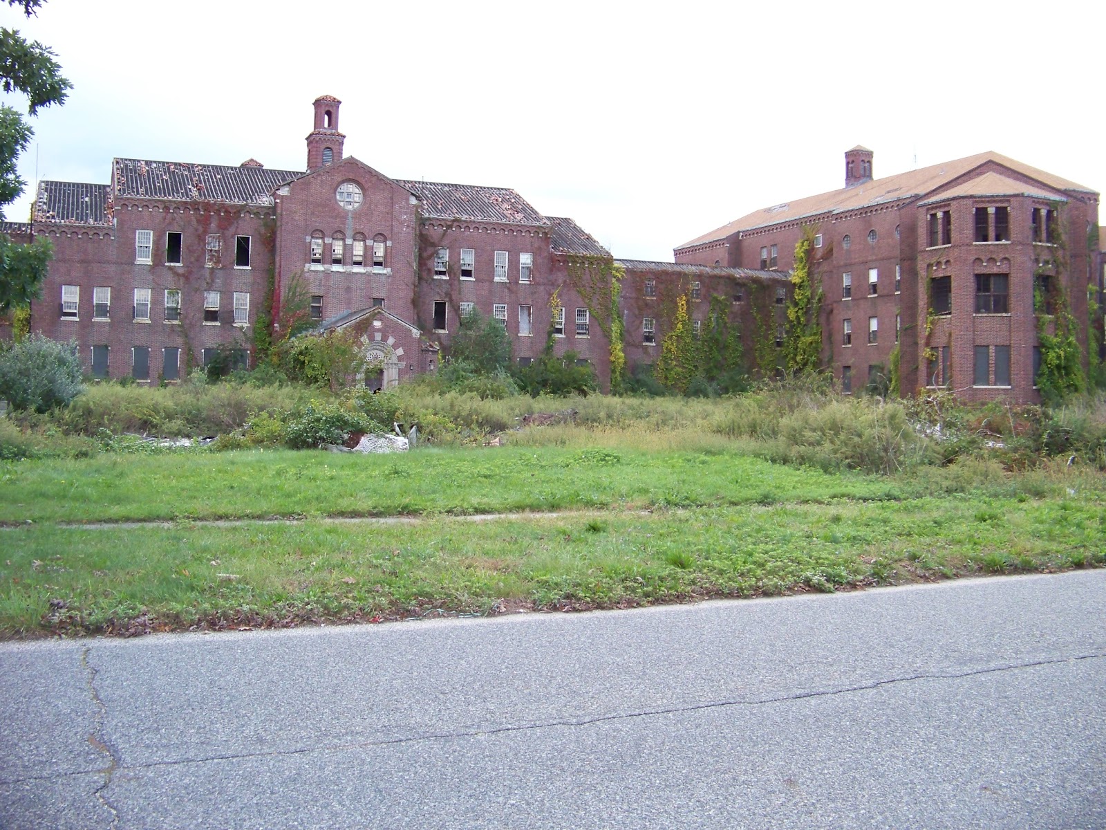
Apparently, this Pilgrim State Hospital, opened in 1931, was once the largest of its type in the world. You can read the details HERE.
They still use this facility on a greatly downsized measure now, but by looking at the above linked BING map, you can see how large this place once was. The following pictures show a few of the remaining original buildings. I only had the cell phone camera w/ me, and the sun wasn't w/ me, so some of the pictures aren't the best, sorry.
Enjoy.
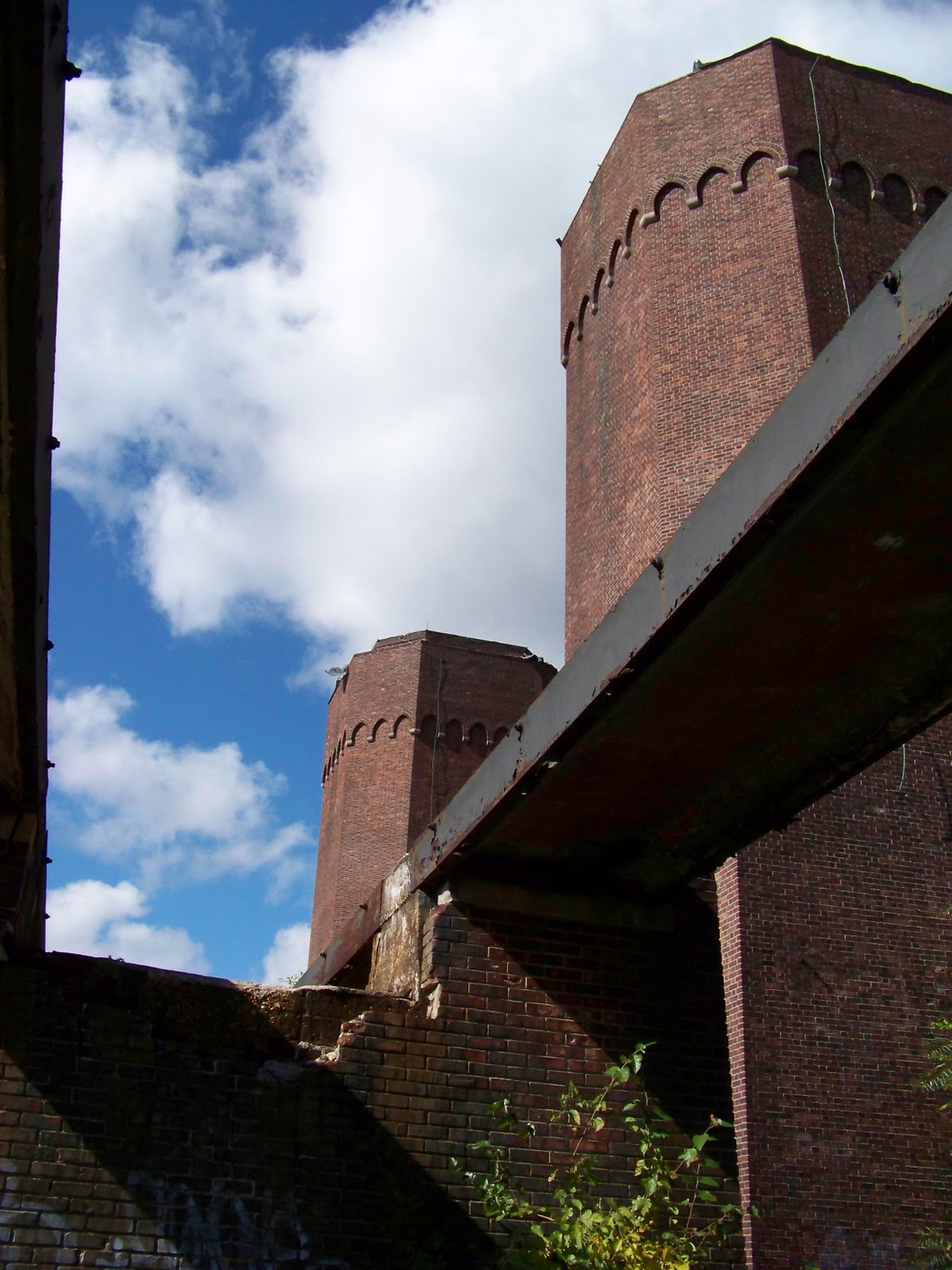
Brick Water Tower
Inside Water Tower
Debris Field from razed buildings
Empty tree lined streets
Looking up into the water tower
So, after I posted this, did some more research and found the cemetery's location....took these shots and some video. I was sort of amazed at just how large it actually was. I read 10 acres. If you died, and no one claimed you, you wound up here. It was said that at least one patient died every day here.
OCTOBER 2 2011 Update.....
So I went out for a run this morning and stumbled across the abandoned power generating station for the hospital. It is a giant complex, basically all boarded up, but there were a few holes.......