Yesterday, Chip and I headed out to scout some new locations and enjoy the mid 60 degree temperatures of the end of January. We hopped the ferry in Fredericktown and headed to the Fayette landing of the Crucible ferry. Chip had it in his head to climb the huge waste piles from the Crucible mine (yea, we know the dangers) and take some pictures. When we got there, via walking north up the railroad tracks, we quickly decided this sounded better in theory then in reality, so we put that entry point on the back burner for now.
 |
| Crucible mine slate dumps now |
And.......
 |
| Then...1938. |
Below, are two shots of the same area. In the 1939 one, you can see the area open, and a building there. In the 1959 shot, the area seems to be getting over grown and the building gone.
  |
| Hard to see here, but this old foundation runs to the river and is exceedingly large. |
It's weird. I've lived my whole adult life in Greene county, but know very little history from right across the river in Fayette county, and that was evident today as we walked the CSX tracks.
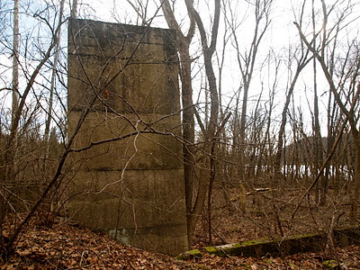
About a tenth of a mile north of the ferry landing we ran into these ruins....
A little further up the tracks we ran into this.....
Obviously, some sort of pumping operation, but for what? I know down the river at Ronco, an old water treatment plant existed years ago, but I think that serviced the town of Ronco. There is really nothing around these old buildings/foundations.
The area in question is shown in this picture, taken in 1938. You can see the Crucible mine on the Greene side w/ all its barges and buildings, but in the questioned area, it doesn't look like there is a whole lot going on.
 |
| View of the old Crucible mine site from Fayette |
And for you boaters, its basically behind the Omaha Beach area, as pictured here:
So, the question is, what in fact was this place once? Any ideas?


